Orbit
RF / Link
Ground Stations
Simulation Window
Link Budget: Downlink
Elevation: zenith (90°)
—
Link Margin (Eb/N0 − Required)
Waterfall
 The Gideon Corp.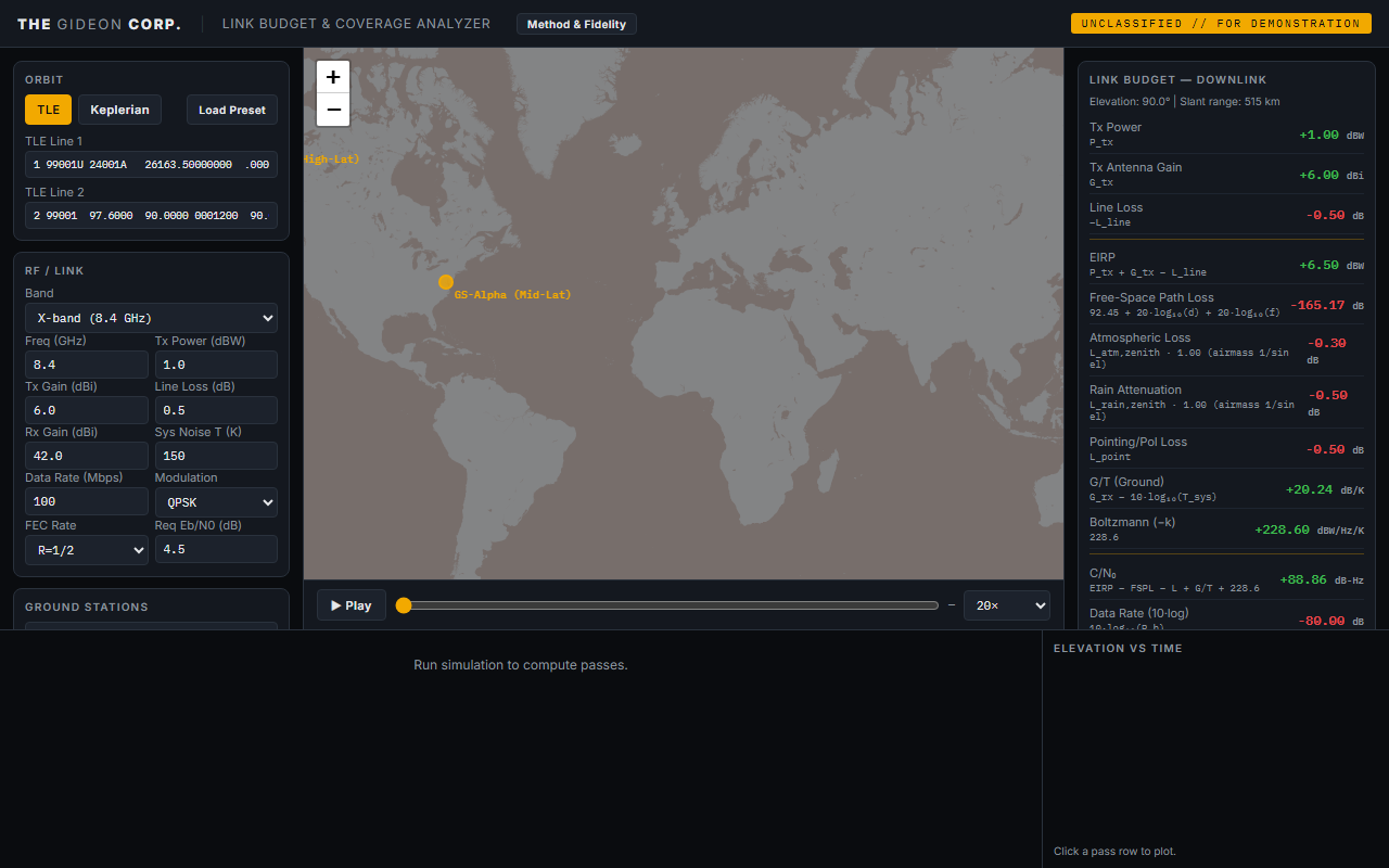
Real RF link-budget and orbital-access math: link margin, coverage footprint, and ground-station pass schedules driven by SGP4 propagation. The same physics as the heavy reference tools, lighter and owned.
This is a multi-panel console built for a desktop. Open it on a larger screen to run the live analyzer.
← All work
SGP4 / SDP4 (Simplified General Perturbations 4), the industry-standard analytic model for near-Earth satellites. Implemented via satellite.js (Vallado 2006 / Celestrak). Accounts for J2 oblateness, atmospheric drag (via B* drag term in TLE). Valid range: 200 to 2000 km circular orbits, short-arc predictions (days). Error: typically <1 km position error over 1 to 2 day arcs with fresh TLE.
EIRP = P_tx + G_tx − L_line, effective isotropic radiated powerFSPL = 92.45 + 20·log₁₀(d_km) + 20·log₁₀(f_GHz), ITU-R P.525-3 free-space path lossC/N₀ = EIRP − FSPL − L_other + G/T + 228.6, standard RF link equationEb/N₀ = C/N₀ − 10·log₁₀(R_b), bit energy to noise densitySlant range computed from spherical-Earth geometry (R_e = 6371 km) using satellite altitude and elevation angle. Footprint radius via the rigorous Earth-central-angle formula ρ = acos((R_e/(R_e+h))·cos(el)) − el, where the trailing − el is the local-horizon correction; omitting it (geocentric approximation) overstates the radius by a few percent at low mask angles. Accurate to <0.5% vs WGS-84 ellipsoid at LEO altitudes.
≈ 1/sin(el) (clamped at 5° elevation to bound the horizon singularity), so low-elevation passes lose meaningfully more. Approximates ITU-R P.676; use the full model for operational analysis.≈ 1/sin(el) airmass. Actual depends on region and climate zone. Use ITU-R P.618 for fade-margin sizing.Access windows computed by propagating SGP4 at configurable time steps, computing look angles (azimuth, elevation, range) to each ground station using Leaflet/satellite.js ecfToLookAngles, and recording intervals where elevation ≥ minimum mask angle.
The link-budget and orbital-access math a smallsat operator needs, all in the browser: will my signal close, where does the satellite cover, and when can my ground station talk to it.
Load the Operator B preset, then lower the data rate and watch the margin go green.
We configure it to your spacecraft, bands, and ground network, lighter than the reference tools, and yours to keep.